Description
Practical Handbook of Remote Sensing
Authors: Lavender Samantha, Lavender Andrew
Language: English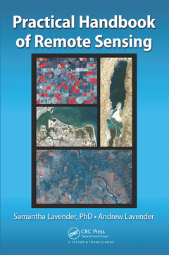
Subjects for Practical Handbook of Remote Sensing:
Keywords
Meris; False Color Composite; Geospatial; Remote Sensing; Earth Observation; Data Sets; Spatial Analysis; Spectral Wavebands; Satellite; Space; Data; MODIS Data; Spatial modeling; RGB Image; Environmental Monitoring; Histogram Stretch; Snap; VIIRS; Landsat Scene; SRTM DEM; MODIS L2; Remote Sensing Reflectance; SRTM DEM Data; NDWI; OSI SAF; MODIS LST; Object Based Image Analysis; Average DN; Spectral Angle Mapping; Weld; Aster Spectral Library; Sea Ice Satellite Application Facility; UK Disaster Monitoring Constellation
Approximative price 220.72 €
In Print (Delivery period: 14 days).
Add to cart the book of Lavender Samantha, Lavender Andrew
Publication date: 11-2017
· 15.2x22.9 cm · Hardback
Approximative price 83.43 €
In Print (Delivery period: 15 days).
Add to cart the book of Lavender Samantha, Lavender Andrew
Publication date: 10-2015
· 15.2x22.9 cm · Paperback
Description
/li>Contents
/li>Readership
/li>Biography
/li>
A Beginner?s Guide to the World of Satellite Data
Over a thousand active satellites are in orbit around the Earth with applications including navigation, the transmission of data and satellite remote sensing; a space-based technology providing data accessible to everyone. The Practical Handbook of Remote Sensing offers a complete understanding of the basic scientific principles needed to perform practical remote sensing at home or at work, using a personal computer. This book contains the information needed to effectively find, download, analyze, and view environmental data. Written by an expert with more than 15 years of experience along with the perspective of a non-expert navigating his way through remote sensing for the first time, it serves as a guidebook for anyone wanting to use remote sensing technology without becoming an expert on the subject.
No Previous Knowledge Required
The book explains the science behind remote sensing; describing what it is, how it works, and how it can be used in real life applications. Using just a standard personal computer, the authors help readers discover a wide variety of satellite imagery and how these images can be used to monitor environmental changes in real-world application areas: urban environments, natural landscape, terrestrial water cycle, and coastal environments. The book primarily concentrates on practically using optical data from the Landsat missions with further examples based on MODIS, TerraSAR-X and pre-processed datasets such as those provided by the Copernicus Services. It also provides a review of near-future developments in satellites, sensors, and the processing of data, along with a review of near-future applications and longer-term developments.
In addition, this book:
- Includes a complementary website providing additional support, satellite images, videos, updates on satellite data and a FAQ/forum to answer readers? questions
- Gives readers detailed hands-on practical exercises on how to find, download, process and visualize freely available satellite remote sensing data, coupled with result-comparisons
- Demonstrates how satellite data can be used to provide a range of environmental monitoring for both small local areas and across the globe
What Is Remote Sensing? How Does Remote Sensing Work? Data Available from Remote Sensing. Basic Remote Sensing Using Landsat Data. Introduction to Image Processing. Practical Image Processing. Geographic Information System and an Introduction to QGIS. Urban Environments and Their Signatures. Landscape Evolution. Inland Waters and the Water Cycle. Coastal Waters and Coastline Evolution. Where to Next?
Dr. Samantha Lavender has more than 15 years of remote sensing research experience, with a focus on the use of Earth observation. After a PhD focused on the remote sensing of the Humber plume using airborne data, she was a researcher at Plymouth Marine Laboratory and then a lecturer at the University of Plymouth. In 2012, with Andrew, she formed Pixalytics Ltd and is the Managing Director of this commercial remote sensing company. She has an ongoing active interest in research alongside widening the community using remotely sensed data. She’s also director of Ocean Nourishment Ltd, an honorary reader of geomatics at Plymouth University and chairman of the British Association of Remote Sensing Companies (BARSC), having previously been chairman of the Remote Sensing and Photogrammetry Society (RSPSoc).
Mr. Andrew Lavender