Description
Advances in Web-based GIS, Mapping Services and Applications
ISPRS Book Series
Coordinators: Li Songnian, Dragicevic Suzana, Veenendaal Bert
Language: English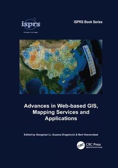
Subjects for Advances in Web-based GIS, Mapping Services and Applications:
Keywords
VGI; open; Geospatial Web; geospatial; API Function; consortium; OGC Standard; location; Semantic Web; google; WMS; earth; KML File; scalable; Geospatial Cyberinfrastructure; vector; IP Address; graphics; NASA World Wind; volunteered; Tcp; AJAX Request; Web Mapping; OGC Web; Case Study; User Generated Data Content; Public Participatory GIS; WPS; OGC Web Feature Service; OGC Sensor Observation Service; SDI; Spatial Web Portal; Progressive Transmission; OGC Web Map Service; Spatial Index

Publication date: 06-2017
· 17.4x24.6 cm · Paperback
Publication date: 05-2011
386 p. · 17.4x24.6 cm · Hardback
Description
/li>Contents
/li>Biography
/li>
Advances in Web-based GIS, Mapping Services and Applications is published as part of ISPRS WG IV/5 effort, and aims at presenting (1) Recent technological advancements, e.g., new developments under Web 2.0, map mashups, neogeography and the like; (2) Balanced theoretical discussions and technical implementations; (3) Commentary on the current stages of development; and (4) Prediction of developments over the next decade. Containing 21 contributions from 60 researchers active within ISPRS communities, most of them from academia and some from governments, the book covers a wide range of topics related to the state-of-the-art in web mapping/GIS and geographic information services. The volume is organized in five sections:
1. Analytical and Geospatial Services;
2. Performance;
3. Augmentation and LBS;
4. Collaboration and Decision Making, and 5. Open Standards for Geospatial Services.
Supported by a considerable number of technical details and examples, an overall view of the current achievements and progress made in the field of web-based GIS and mapping services is given. The chapters reflect timely and future developments addressing: constant updating of related web and geospatial technologies as well as the revolution of web mapping caused by mainstream IT vendors such as Google, Yahoo and Microsoft; increased interest from industry on geo-spatial information technologies; and increasing demand from the general public for prompt and effective spatial information services. Advances in Web-based GIS, Mapping Services and Applications will appeal to academia and researchers, application specialists and developers, practitioners, and undergraduate and graduate students interested in distributed and web-based geoinformation systems and applications, geodatabases, and digital mapping.
Preface
Acknowledgements
Contributors
Introduction
Analytical and geospatial services
Performance
Augmentation and location-based services
Collaboration and decision making
Open standards for geospatial services
Author index
Keyword index
ISPRS Book Series
Songnian Li is Associate Professor in Geomatics Engineering at the Ryerson University, Canada. He is the Chair of the ISPRS Working Group IV/5 on "Distributed, Web-based Geoinformation Services and Applications". His current research interests include web mapping and geospatial services, collaborative GIS systems and decision support, geospatial data acquisition, and spatiotemporal analysis applications.
Suzana Dragicevic is Professor at Geography Department at Simon Fraser University, Canada. She is the Secretary of the ISPRS Working Group IV/5 on "Distributed, Web-based Geoinformation Services and Applications". Her primary research interests include geographic information systems (GIS) and science, spatial data analysis and modelling, complex systems, fuzzy sets and systems, temporal GIS, web-based and collaborative GIS.
Bert Veenendaal is Professor in Geographic Information Science and Head of Department of Spatial Sciences at Curtin University of Technology, Australia. He is a co-chair of the ISPRS Working Group IV/5 on "Distributed, Web-based Geoinformation Services and Applications". His current research interests include geographic information science, geospatial analysis and data handling, geospatial web mapping and services, collaborative GIS and virtual/interactive e-learning.