Lavoisier S.A.S.
14 rue de Provigny
94236 Cachan cedex
FRANCE

Heures d'ouverture 08h30-12h30/13h30-17h30
Tél.: +33 (0)1 47 40 67 00
Fax: +33 (0)1 47 40 67 02


Url canonique : www.lavoisier.fr/livre/autre/environmental-geoinformatics/descriptif_4134282
Url courte ou permalien : www.lavoisier.fr/livre/notice.asp?ouvrage=4134282

Environmental Geoinformatics (2nd Ed., 2nd ed. 2019) Extreme Hydro-Climatic and Food Security Challenges: Exploiting the Big Data Environmental Science Series

Langue : Anglais

Auteurs :

Couverture de l’ouvrage Environmental Geoinformatics
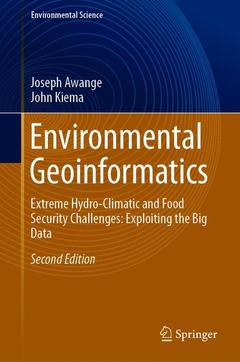
This second edition includes updated chapters from the first edition as well as five additional new chapters (Light detection and ranging (LiDAR), CORONA historical de-classified products, Unmanned Aircraft Vehicles (UAVs), GNSS-reflectometry and GNSS applications to climate variability), shifting the main focus from monitoring and management to extreme hydro-climatic and food security challenges and exploiting big data. Since the publication of first edition, much has changed in terms of technology, and the demand for geospatial data has increased with the advent of the big data era. For instance, the use of laser scanning has advanced so much that it is unavoidable in most environmental monitoring tasks, whereas unmanned aircraft vehicles (UAVs)/drones are emerging as efficient tools that address food security issues as well as many other contemporary challenges. Furthermore, global navigation satellite systems (GNSS) are now responding to challenges posed by climate change by unravelling the impacts of teleconnection (e.g., ENSO) as well as advancing the use of reflected signals (GNSS-reflectometry) to monitor, e.g., soil moisture variations. Indeed all these rely on the explosive use of ?big data? in many fields of human endeavour.

Moreover, with the ever-increasing global population, intense pressure is being exerted on the Earth?s resources, leading to significant changes in its land cover (e.g., deforestation), diminishing biodiversity and natural habitats, dwindling fresh water supplies, and changing weather and climatic patterns (e.g., global warming, changing sea level). Environmental monitoring techniques that provide information on these are under scrutiny from an increasingly environmentally conscious society that demands the efficient delivery of such information at a minimal cost. Environmental changes vary both spatially and temporally, thereby putting pressure on traditional methods of data acquisition, some of which are highly labour intensive, such as animal tracking for conservation purposes. With these challenges, conventional monitoring techniques, particularly those that record spatial changes call for more sophisticated approaches that deliver the necessary information at an affordable cost. One direction being pursued in the development of such techniques involves environmental geoinformatics, which can act as a stand-alone method or complement traditional methods.
Environmental Monitoring and Management.- Geodata and Geoinformatics.- Fundamentals of Surveying and Geodesy.- Modernization of GNSS.- The Global Positioning System.- Environmental Surveying and Surveillance.- Fundamentals of Remote Sensing.- Optical Remote Sensing.- Microwave Remote Sensing.- Image Interpretation and Analysis.- Fundamentals of Photogrammetry.- Digital Photogrammetry.- CORONA Historical De-classified Products.- Fundamentals of GIS.- Data Models and Structure.- Input of GIS Data.- GIS Database.- Spatial Analysis.- Web GIS and Mapping.- Unmanned Aircraft Vehicles.- Light Detection And Ranging (LiDAR).- Maps in Environmental Monitoring.- Satellite Environmental Sensing.- GNSS Reflectometry and Applications.- Weather, Climate and Global Warming.- GNSS Sensing of Climate Variability.- Water Resources.- Land Management.- Marine and Coastal Resources.- Protection and Conservation of Animals and Vegetation.- Disaster Monitoring and Management.- Environmental Pollution.- Environmental Impact Assessment.
Professor Joseph Awange joined Spatial Sciences (School of Earth and Planetary Sciences, Curtin University, Australia) in 2006 under a Curtin Research Fellowship and concurrently undertook the prestigious Alexander von Humboldt (AvH) Fellowship at the Geodetic Institute (Karlsruhe Institute of Technology, Germany) having been awarded the Australian 2008–2011 Ludwig Leichhardt Memorial Fellowship for experienced researchers. In 2015, he won all the three major Fellowship Awards: Alexander von Humboldt (Germany), Japan Society of Promotion of Science (Japan) and Brazil Frontier of Science (Brazil) to carry out research in those countries. At Curtin University, he is currently a Professor of Environmental Geoinformatics engaged in teaching and research having attracted more than $2.5M worth of research grants. He obtained his BSc and MSc degrees in Surveying from the University of Nairobi (Kenya), and was also awarded a merit scholarship by the German Academic Exchange Program (DAAD), which facilitated his obtaining a second MSc degree and PhD in Geodesy at Stuttgart University (Germany). In 2002–2004, he was awarded the prestigious Japan Society for Promotion of Science (JSPS) Fellowship to pursue postdoctoral research at Kyoto University (Japan).  Prof Awange attained International Editorial role in Springer Earth Science Books and has authored 15 scholarly books with the prestigious Springer International publishers and more than 160 peer-reviewed high impact journal publications (in e.g., Remote Sensing of Environment, Journal of Climate, Climatic Change, Advances in Water Resources, International Journal of Climatology, and Journal of Hydrology among others). His main research areas that have attracted media coverage (e.g., Environmental Monitor) are in the fields of (i) Environmental Geoinformatics: Satellite Environmental Sensing (e.g., changes in global and regional stored water (surface, underground, ice, and soil moisture) using GRACE and TRMM satellite
Brings together multi-disciplinary techniques to support the acquisition, analysis, and visualisation of geodata

Includes numerous colour photos, as well as relevant and practical examples

Features special chapters on applications and updated technologies involving big data and new challenges

Date de parution :

Ouvrage de 635 p.

15.5x23.5 cm

Disponible chez l'éditeur (délai d'approvisionnement : 15 jours).

Prix indicatif 158,24 €

Ajouter au panier