Description
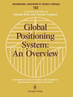
Global Positioning System: An Overview, Softcover reprint of the original 1st ed. 1990
Symposium No. 102 Edinburgh, Scotland, August 7–8, 1989
International Association of Geodesy Symposia Series, Vol. 102
Coordinators: Bock Yehuda, Leppard Norman
Language: English
Publication date: 05-1990
447 p. · 21x27.9 cm · Paperback
447 p. · 21x27.9 cm · Paperback
Description
/li>Contents
/li>
Space geodesy has evolved in the last twenty years into one of the most exciting disciplines in the earth sciences. This development is due to a large extent to the versatility of applications provided by the radio interferometric technique called Global Positioning System or GPS. Appropriately, Symposium 102: Global Positioning System: An Overview was held at the 125th Anniversary Meeting of the International Association of Geodesy in August, 1989. A broad review of GPS geodesy, achievements to date and the prospects for future study and application was presented. Papers included in this volume are grouped as follows: - Static and Geodynamic Positioning; - Orbit Determination Optimization and Design Dynamic; - Kinematic GPS/INS Radio Tracking Systems A useful reference for any researcher or student of space geodesy.
and Program.- Static and Geodynamic Positioning — IAG Special Study Group 1.140.- Relative Static Positioning with the Global Positioning System: Basic Technical Considerations Keynote Presentation.- Present Capabilities of GPS for High-Precision Regional Surveys Keynote Presentation.- Continuously Monitoring GPS Networks for Deformation Measurements Keynote Presentation.- GPS Data Preprocessing for Cycle-Slip Detection.- On Preprocessing of GPS Data.- A Comparison of Several Techniques to Reduce Signal Multipath from the Global Positioning System.- Multipath Effects in Static and Kinematic GPS Surveying.- GPS Observations in a Local Network Covering Big Height Differences.- Interim Status Report on Dönav.- Repeatable Measurements of Baseline Length by Global Positioning System in Central Japan.- Some First Experiences with the WM102 GPS Receiver.- Monitoring Displacements by GPS: A Calibration Test.- Some Results in the Preliminary Data Analyses of the Fixed-Point GPS Baseline Determination Network in Central Japan.- The Resolution of Mean Sea Level Anomalies Along the New South Wales Coastline by GPS.- Orbit Determination — IAG Special Study Group 2.106 & CSTG Subcommission.- High Accuracy Global Positioning System Orbit Determination: Progress and Prospects Keynote Presentation.- The Development of a Global GPS Tracking System in Support of Space and Ground-Based GPS Programs Keynote Presentation.- GPS Orbits and Baseline Experiments: Mini-Mac/TI Comparisons.- Orbit Determination for GPS Satellites.- High-Precision GPS Positioning by Fiducial Techniques.- GPS Broadcast Orbits Versus Precise Orbits: A Comparison Study.- Optimization and Design — IAG Special Study Group 4.117.- Optimization of GPS Theory, Techniques and Operational Systems: Progress andProspects Keynote Presentation.- Strain Analysis of Systematic Distortions of GPS Networks.- Optimizing the Movement of GPS Receivers.- Optimum Positions for GPS Points and Supporting Fix Points in Geodetic Networks.- Logistic Optimization for GPS Satellite Networks by Generalized S.O.D. Algorithms.- GPS Vertical Surveying: A Discussion of Some Special Considerations.- Statistical Testing and Quality Analysis of 3-D Networks—Part I: Theory.- Statistical Testing and Quality Analysis of 3-D Networks—Part II: Application to GPS.- Dynamic, Kinematic GPS/INS — IAG Special Study Group 1.105.- Kinematic Applications of GPS and GPS/INS Algorithms, Procedures, and Equipment Trends Keynote Presentation.- A Discussion of Models for GPS/INS Integration.- German-Canadian Experiment in Airborne INS-GPS Integration for Photogrammetric Applications.- The Use of Phase for Kinematic Positioning by GPS.- High Precision Kinematic Positioning Using GPS at the IGN: Recent Results.- Radio Tracking Systems — IAG Special Study Group 2.54.- Geoscience from GPS Tracking by Earth Satellites Keynote Presentation.- Mapping the Earth’s Gravity Field with Orbiting GPS Receivers Keynote Presentation.- The DORIS Satellite Radio Tracking System: Status and Plans.- PRARE—Status and Prospects.- Methods of Realisation of Coherent Signals in Satellite Systems.- Appendix 1 — Presidential Address.- Mueller, Ivan I., 125 Years of International Cooperation in Geodesy.- Appendix 2 — List of Participants.- Author Index.
© 2024 LAVOISIER S.A.S.


