Description
Hyperspectral Indices and Image Classifications for Agriculture and Vegetation (2nd Ed.)
Hyperspectral Remote Sensing of Vegetation
Hyperspectral Remote Sensing of Vegetation, Second Edition Series
Coordinators: Thenkabail Prasad S., Lyon John G., Huete Alfredo
Language: English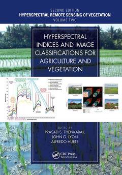
Subjects for Hyperspectral Indices and Image Classifications for...:
Keywords
Hyperspectral Data; Hyperspectral Vegetation Indices; hyperspectral remote sensing; Leaf Equivalent Water Thickness; hyperspectral image classification; agricultural crops monitoring; LCC; hyperspectral derivative vegetation indices; Estimate Vegetation Water Content; hyperspectral narrowband vegetation indices; Red Edge; Estimate Leaf Chlorophyll Content; Vegetation Water Content; SWIR Wavelength; Canopy Water Content; Spectral Indices; Hyperspectral Image; Canopy Radiative Transfer Models; Red Edge Position; MLR; Canopy Reflectance Spectra; Leaf Optical Properties; NIR Spectral Region; MTCI; Canopy Structural Variation; Smooth Methods; Foliar Pigments; Data Set

Publication date: 01-2023
· 17.8x25.4 cm · Paperback
Publication date: 12-2018
· 17.8x25.4 cm · Hardback
Description
/li>Contents
/li>Biography
/li>
Written by leading global experts, including pioneers in the field, the four-volume set on Hyperspectral Remote Sensing of Vegetation, Second Edition, reviews existing state-of- the-art knowledge, highlights advances made in different areas, and provides guidance for the appropriate use of hyperspectral data in the study and management of agricultural crops and natural vegetation.
Volume II, Hyperspectral Indices and Image Classifications for Agriculture and Vegetation evaluates the performance of hyperspectral narrowband or imaging spectroscopy data with specific emphasis on the uses and applications of hyperspectral narrowband vegetation indices in characterizing, modeling, mapping, and monitoring agricultural crops and vegetation. This volume presents and discusses topics such as the non-invasive quantification of foliar pigments, leaf nitrogen concentration of cereal crop, the estimation of nitrogen content in crops and pastures, and forest leaf chlorophyll content, among others. The concluding chapter provides readers with useful guidance on the highlights and essence of Volume II through the editors? perspective.
Key Features of Volume II:
- Provides the fundamentals of hyperspectral narrowband vegetation indices and hyperspectral derivative vegetation indices and their applications in agriculture and vegetation studies.
- Discusses the latest advances in hyperspectral image classification methods and their applications.
- Explains the massively big hyperspectral sensing data processing on cloud computing architectures.
- Highlights the state-of-the-art methods in the field of hyperspectral narrowband vegetation indices for monitoring agriculture, vegetation, and their properties such as plant water content, nitrogen, chlorophyll, and others at leaf, canopy, field, and landscape scales.
- Includes best global expertise on hyperspectral remote sensing of agriculture, crop water use, plant species detection, crop productivity and water productivity mapping, and modeling.
Section I: Hyperspectral Vegetation Indices
- Hyperspectral vegetation indices
- Derivative hyperspectral vegetation indices in characterizing forest biophysical and biochemical quantities
- Hyperpsectral image classification methods in vegetation and agricultural
- Big Data Processing on Cloud Computing Architectures for Hyperspectral Remote Sensing
- Non-invasive Quantification of Foliar Pigments: Principles and Implementation
- Hyperspectral Remote Sensing of Leaf Nitrogen Concentration in Cereal Crops
- Optical remote sensing of vegetation water content
- Estimation of nitrogen content in herbaceous plants using hyperspectral vegetation indices
- Hyperspectral remote sensing of leaf chlorophyll content: from leaf, canopy, to landscape scales
- Fifty-years of Advances in Hyperspectral Remote Sensing of Agriculture and Vegetation: Summary, Insights, and Highlights of Volume II: Hyperspectral Vegetation Indices and Image Classifications for Agriculture and Vegetation
[Dar A. Roberts, Keely L. Roth, Erin B. Wetherley, Susan K. Meerdink, and Ryan L. Perroy]
[Quan Wang, Jia Jin, Rei Sonobe, and Jing Ming Chen]
Section II: Hyperspectral Image Classification Methods and Approaches
cropland studies
[Edoardo Pasolli, Saurabh Prasad, Melba M. Crawford, and James C. Tilton]
[Zebin Wu, Jin Sun, and Yi Zhang]
Section III: Hyperspectral Vegetation Indices Applications to Agriculture and Vegetation
[Anatoly Gitelson and Alexei Solovchenko]
[Tao Cheng, Yan Zhu, Dong Li, Xia Yao, and Kai Zhou]
[Colombo Roberto, Busetto Lorenzo, Meroni Michele, Rossini Micol, and Panigada Cinzia]
[D. Stroppiana, F. Fava, M. Boschetti, and P.A. Brivio]
[Yongqin Zhang]
Section IV: Conclusions
[Prasad S. Thenkabil, John G. Lyon, and Alfredo Huete]
Dr. Prasad S. Thenkabail, Research Geographer-15, U.S. Geological Survey (USGS), is a world-recognized expert in remote sensing science with multiple major contributions in the field sustained over more than 30 years. He obtained his PhD from the Ohio State University in 1992 and has over 140+ peer-reviewed scientific publications. Dr. Thenkabail has conducted pioneering cutting-edge research in the area of hyperspectral remote sensing of vegetation (https://www.usgs.gov/wgsc/GHISA/) and in that of global croplands and their water use for food security (www.croplands.org). Dr. Thenkabail’s contributions to series of leading edited books on remote sensing science along with his research and other contributions in the subject places his as a noted global expert in remote sensing science. He edited three-volume book entitled Remote Sensing Handbook published by Taylor and Francis, with 82 chapters and more than 2000 pages, widely considered a "magnus opus" encyclopedic standard reference for students, scholars, practitioners, and major experts in remote sensing science. He has recently completed editing four-volume Hyperspectral Remote Sensing of Vegetation. He has also edited a book on Remote Sensing of Global Croplands for Food Security. He is currently an editor-in-chief of the Remote Sensing open access journal published by MDPI; an associate editor of the journal Photogrammetric Engineering and Remote Sensing (PERS) of the American Society of Photogrammetry and Remote Sensing (ASPRS); and an editorial advisory board member of the International Society of Photogrammetry and Remote Sensing (ISPRS) Journal of Photogrammetry and Remote Sensing. NASA and USGS selected him on the Landsat Science team (2007-2011). Earlier, he served on the editorial board of Remote Sensing of Environment for many years (2007–2017). He has won three best paper awards from ASPRS for his publications in PE&RS.