Description
Sustainable Watershed Development, 1st ed. 2020
A Case Study of Semi-arid Region in Maharashtra State of India
SpringerBriefs in Water Science and Technology Series
Author: Pande Chaitanya Baliram
Language: English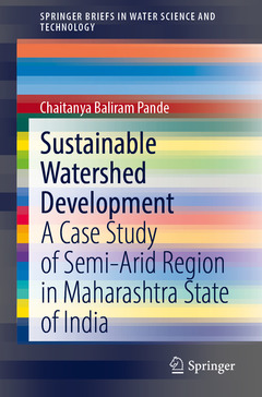
Subjects for Sustainable Watershed Development:
Approximative price 52.74 €
In Print (Delivery period: 15 days).
Add to cart the book of Pande Chaitanya Baliram
69 p. · 15.5x23.5 cm · Paperback
Description
/li>Contents
/li>Biography
/li>Comment
/li>
This book presents a case study on a semi-arid region, Maharashtra State, India, and discusses problems concerning a broad range of areas: sustainable watershed development; watershed management; groundwater condition; land and resource development plans; thematic maps on e.g. land use, soil types and soil erosion; groundwater recharge site selection; remote sensing and GIS; and soil and water conservation structures. The book?s focus is on creating a land and water resource development plan and environmental management for groundwater recharge development using remote sensing and GIS technology in the case study region, which is situated in the Akola and Buldhana districts of Maharashtra. Its goal is to promote awareness for sustainable watershed development and planning in semi-arid regions by highlighting the problems of, and plans for, groundwater and surface water pollution and sustainable watershed development. These aspects are of great importance to watershed and natural resources planning and management, and need to be exploited and managed sustainably.
Given its scope, the book will be of interest to all scientists, research scholars and graduate students of remote sensing, hydrology, hydrogeology, water resource engineering, agricultural engineering and related areas who want to acquire detailed information on watershed planning and sustainable water resource planning in semi-arid regions, or to find new methodologies and techniques for studying the feedback mechanisms between forms and processes.
- Introduction - Maharashtra State of India
- Watershed Management and Development Integrated Watershed Management Philosophy
- Watershed Management
- Watersheds and Stream Orders
- Watershed Assessments
- Sustainable Use and Development of Natural Resources
- Land and Water Scarcity
- Remote Sensing and GIS For Integrated Watershed Management Watershed Management Practices
- Thematic Mapping of Watershed Development
- Water Resources Development Plan
- Ground Water Condition
- Land and Water Resources Development Plan
- Groundwater and Artificial Recharge Planning
Dr. Chaitanya B. Pande (Dr. PDKV, Akola), Ph.D. (Sant Gadge Baba Amravati University, Amravati) has published 39 research papers in international journals with Springer and Elsevier. His research interests include Remote Sensing, GIS, Watershed Management, Hydrogeology, Hydrological Modeling, Land Use and Land Cover Analysis, Groundwater Quality, Urban Planning, Hydrogeochemistry, Groundwater Modeling, Geology, Hyperspectral Remote Sensing, Remote Sensing and GIS Application in Natural Resources Management, Watershed Management and Environmental Monitoring.
Dr. Pande has many years of research and industrial experience and has served as a reviewer for e.g. Earth Science Research Journal, American Journal of Geophysics, Geochemistry, and Geosystems, Groundwater Sustainable Development (Elsevier) and Environmental Sustainable Development (Springer).
Introduces the basic concept of watershed development and management based on remote sensing and GIS technology
Provides thematic maps for sustainable water resources development planning
Features examples of soil and water conservation structures based on potential groundwater zones and satellite data