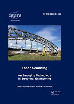
Laser Scanning An Emerging Technology in Structural Engineering ISPRS Book Series
Coordonnateurs : Riveiro Belén, Lindenbergh Roderik

This book provides an overview on the evolution of laser scanning technology and its noticeable impact in the structural engineering domain. It provides an up-to-date synthesis of the state-of-the-art of the technology for the reverse engineering of built constructions, including terrestrial, mobile, and different portable solutions, for laser scanning. Data processing of large point clouds has experienced an important advance in the last years, and thus, an intense activity in the development of automated data processing algorithms has been noticed. Thus, this book aims to provide an overview of state-of-the-art algorithms, different best practices and most recent processing tools in connection to particular applications.
Readers will find this a comprehensive book, that updates the practice of laser scanning for researchers and professionals not only from the geomatic domain, but also other fields such as structural and construction engineering. A set of successful applications to structural engineering are illustrated, including also synergies with other technologies, that can inspire professionals to adopt laser scanning in their day-to-day activity.
This cutting-edge edited volume will be a valuable resource for students, researchers and professional engineers with an interest in laser scanning and its applications in the structural engineering domain.
Multispectral terrestrial lidar: state of the art and challenges, Multiplatform mobile laser scanning, Introduction to mobile mapping with portable systems, Indoor modeling with Laser Scanning, Geometric point cloud quality, Semantic Segmentation of Dense Point Clouds, Object identification / change detection and deformation monitoring, A Smart Point Cloud Infrastructure for intelligent environments, Integration of TLS and Sonar for the modelling of semi-immersed structures, Integral diagnosis and structural analysis of historical constructions by terrestrial laser scanning, Laser scanning for bridge inspection,Laser scanning data for inverse problems in structural engineering, Construction site monitoring based on laser scanning data, Integrated Modelling and Management Information System (MMIS) for SCAN to BIM projects.
Dr. Belén Riveiro was born in Pontevedra (Spain) in 1983. Since 2012 she is an Associate Professor at the Department of Materials Engineering, Applied Mechanics and Construction at the University of Vigo (Spain). She holds a MSc in Construction Engineering (2015), MESc in Forestry Engineering (2006) and a PhD in Environmental Engineering (2011). She has been an Associate Professor in Geomatics at Newcastle University (UK) in 2011, and was a postdoctoral research fellow at the University of Minho (2012 and 2014), the University of Cambridge (2015) and at Delft University of Technology (2016). Her research is focused on the application of remote sensing technologies in structural engineering for the automated modelling, inspection and material characterization using inverse analysis procedures. At a larger scale, she uses LiDAR for the modelling of terrestrial transport infrastructure and urban spaces. She has been principal Investigator in several research and innovation projects (at national and international level) and coordinator of an European action focused on the resilience of transport infrastructure to extreme events (within the H2020 Framework Program). She has published more than 80 research papers in SCI-JCR journals (h-index 22), and more than 60 communications to international conferences. She is co-author of 9 patents and has supervised 6 PhD theses. She is the Secretary of the ISPRS WGII/10 3D Mapping for Environmental & Infrastructure Monitoring for the period 2016-2020. In 2017 she was awarded by the Spanish Royal Academy of Engineering with a medal of the Juan López de Peñalver Prize within the Awards for Young Researchers.
Dr. Roderik Lindenbergh is associate professor in laser scanning at the Dept. of Geoscience and Remote Sensing of Delft University of Technology. He studied mathematics at the University of Amsterdam and studied 6 months at RWTH Aachen for his MSc project on computational group theory. After
Date de parution : 06-2021
17.4x24.6 cm
Disponible chez l'éditeur (délai d'approvisionnement : 14 jours).
Prix indicatif 58,78 €
Ajouter au panierDate de parution : 10-2019
17.4x24.6 cm
Thèmes de Laser Scanning :
Mots-clés :
Point Cloud; Point Cloud Segmentation; Mobile Mapping System; Point Cloud Classification; Acquired Point Cloud; Terrestrial Laser Scanning; TLS Scanner; TLS Instrument; RGB Color; Point Cloud Data; Als; Laser Scanning; TLS Point Cloud; Mobile Laser Scanning; Laser Scanning Point Clouds; Dense Point Clouds; Laser Scan Data; GNSS Receiver; MLS System; MLS Data; MLS Point Cloud; Radiometric Calibration; TLS Data; Visual Slam; Slam Problem


