Description
Exploring the Earth System with Imaging Spectroscopy, 1st ed. 2019
Space Sciences Series of ISSI Series, Vol. 70
Coordinators: Foerster Saskia, Guanter Luis, Lopez Teodolina, Moreno José, Rast Michael, Schaepman Michael E.
Language: English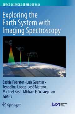
Subjects for Exploring the Earth System with Imaging Spectroscopy:

Exploring the Earth System with Imaging Spectroscopy
Publication date: 09-2020
Support: Print on demand
Publication date: 09-2020
Support: Print on demand
Exploring the Earth System with Imaging Spectroscopy
Publication date: 09-2019
Support: Print on demand
Publication date: 09-2019
Support: Print on demand
Description
/li>Contents
/li>Biography
/li>Comment
/li>
This volume presents a broad overview of the requirements, capabilities, challenges and future directions of spaceborne imaging spectroscopy to explore the Earth?s surface for a range of application domains. These include mine exploration, soil mapping, vegetation monitoring, mapping of pollution and hazardous materials, inland and coastal water monitoring, urban applications and others. Imaging spectroscopy, also often termed hyperspectral remote sensing, for terrestrial Earth observation dates back to the 1980s, when the first spectrometers observing in the visible to shortwave infrared wavelength range were deployed on airborne platforms. From the end of the 1990s onwards, spaceborne hyperspectral missions have demonstrated the capability to provide information on the composition and biochemical and physical characteristics of the Earth?s surface. Today, several hyperspectral spaceborne missions are under development to be launched within the next few years. It can be expectedthat future global and frequent coverage of the Earth?s surface with spaceborne imaging spectroscopy data will bring a major advance in the information depth that future Earth system models and monitoring service developments can be based on.
Previously published in Surveys in Geophysics, Volume 40, Issue 3, 2019
The chapters "Imaging Spectrometry of Inland and Coastal Waters: State of the Art, Achievements and Perspectives", "Imaging Spectroscopy for the Detection, Assessment and Monitoring of Natural and Anthropogenic Hazards", "Assessing Vegetation Function with Imaging Spectroscopy", "Spaceborne Imaging Spectroscopy for Sustainable Agriculture: Contributions and Challenges" are available as open access articles under a CC BY 4.0 license at link.springer.com.
Guest Editorial: International Space Science Institute (ISSI) Workshop on Space-Borne Imaging Spectroscopy for Exploring the Earth’s Ecosystems.- Earth Observation Imaging Spectroscopy for Terrestrial Systems: An Overview of Its History, Techniques, and Applications of Its Missions.- Retrieval of Atmospheric Parameters and Surface Reflectance from Visible and Shortwave Infrared Imaging Spectroscopy Data.- Imaging Spectroscopy for Soil Mapping and Monitoring.- Imaging Spectrometry of Inland and Coastal Waters: State of the Art, Achievements and Perspectives.- Imaging Spectroscopy for the Detection, Assessment and Monitoring of Natural and Anthropogenic Hazards.- Imaging Spectroscopy of Urban Environments.- Assessing Vegetation Function with Imaging Spectroscopy.- Spaceborne Imaging Spectroscopy for Sustainable Agriculture: Contributions and Challenges.- Imaging Spectroscopy of Forest Ecosystems: Perspectives forthe Use of Space-borne Hyperspectral Earth Observation Systems.- Quantifying Vegetation Biophysical Variables from Imaging Spectroscopy Data: A Review on Retrieval Methods.- Variability and Uncertainty Challenges in Scaling Imaging Spectroscopy Retrievals and Validations from Leaves Up to Vegetation Canopies.- Synergies of Spaceborne Imaging Spectroscopy with Other Remote Sensing Approaches.
Saskia Foerster holds a senior scientist position in the Remote Sensing Section at the Helmholtz Centre Potsdam, German Research Centre for Geosciences (GFZ) in Potsdam/Germany. Her research interests include the monitoring of soil and land degradation processes, water resources and natural hazards using multi-sensor Earth observation data. Furthermore, she has been working in the scientific preparation of the German space-borne imaging spectroscopy mission EnMAP for the past ten years.
Teodolina Lopez holds an Earth Science post-doctoral position at the International Space Science Institute (ISSI) in Bern, Switzerland. Her research focuses on the characterisation in (semi-) arid regions of the groundwater flow and transfers and their interaction with the atmosphere. This approach relies on the synergy between Earth Observation dataset (mostly thermal infrared and gravity) with in situ measurements (geophysical, geochemical and geology) and simulations.
Michael E. Schaepman is professor of remote sensing at the University of Zurich, Switzerland. His research focus is on optical remote sensing, in particular quantifying light-matter interactions using forward and inverse radiative transfer models. His current projects are related to developing trait-based approaches to observing functional diversity from regional to global scale using air- and spaceborne satellite missions. He further contributes to assessing genetic mechanisms underlying the behavior of plants in their natural environment by linking genomics, phenomics and spectranomics at different spatial and temporal scales using remote sensing.
Luis Guanter obtained his Ph.D. in Environmental Physics in 2007 from the University of Valencia, Spain. In the last years he has been the Head of the Remote Sensing Section of the GFZ Potsdam and the Principal Investigator of the EnMAP spaceborne imaging spectrosco
Provides a sound overview of the status of terrestrial imaging spectroscopy from space Obtains insight in the most prominent terrestrial imaging spectroscopy applications Finds guidance on requirements for future terrestrial imaging spectroscopy systems
© 2024 LAVOISIER S.A.S.