Description
Fundamentals of Satellite Remote Sensing (3rd Ed.)
An Environmental Approach, Third Edition
Author: Chuvieco Emilio
Language: English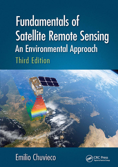
Subjects for Fundamentals of Satellite Remote Sensing:
Keywords
Active Fire Detection; NOAA AVHRR Image; Physical Principles of Remote Sensing; AVHRR NDVI Dataset; Sensors and Remote Sensing Satellites; Landsat-8 OLI; Basis for the Interpretation of Remote Sensing Images; Spectral Radiant Exitance; Visual Interpretation; OLI Image; Digital Image Processing (I): Enhancements and Corrections; USGS EarthExplorer; satellite missions; MODIS Spectral Band; ground radiometers; Landsat-8 OLI Image; object-oriented analysis; Full Polarimetry; LIDAR processing methods; OLI Sensor; Fluorescence; NIR Band; Near-ground missions; MODIS Image; environmental analysis; CORINE Land Cover; machine-learning approaches; RapidEye Image; satellite remote sensing; Radiant Exitance; space-based Earth observation; NIR Reflectance; LIDAR processing; SWIR Band; Spectral VIs; Land Cover Classification System; ToA Reflectance; NDVI Value; Spectral Reflectance Signatures; Color Composite; Lidar Systems

Publication date: 09-2023
· 17.8x25.4 cm · Paperback
Publication date: 02-2020
· 17.8x25.4 cm · Hardback
Description
/li>Contents
/li>Biography
/li>
Fundamentals of Satellite Remote Sensing: An Environmental Approach, Third Edition, is a definitive guide to remote sensing systems that focuses on satellite-based remote sensing tools and methods for space-based Earth observation (EO). It presents the advantages of using remote sensing data for studying and monitoring the planet, and emphasizes concepts that make the best use of satellite data. The book begins with an introduction to the basic processes that ensure the acquisition of space-borne imagery, and provides an overview of the main satellite observation systems. It then describes visual and digital image analysis, highlights various interpretation techniques, and outlines their applications to science and management. The latter part of the book covers the integration of remote sensing with Geographic Information System (GIS) for environmental analysis. This latest edition has been written to reflect a global audience and covers the most recent advances incorporated since the publication of the previous book, relating to the acquisition and interpretation of remotely sensed data.
New in the Third Edition:
- Includes additional illustrations in full color.
- Uses sample images acquired from different ecosystems at different spatial resolutions to illustrate different interpretation techniques.
- Includes updated EO missions, such as the third generations of geostationary meteorological satellites, the new polar orbiting platforms (Suomi), the ESA Sentinels program, and high-resolution commercial systems.
- Includes extended coverage of radar and LIDAR processing methods.
- Includes all new information on near-ground missions, including unmanned aerial vehicles (UAVs).
- Covers new ground sensors, as well as machine-learning approaches to classification.
- Adds more focus on land surface characterization, time series, change detection, and ecosystem processes.
- Extends the interactions of EO data and GIS that cover different environmental problems, with particular relevance to global observation.
Fundamentals of Satellite Remote Sensing: An Environmental Approach, Third Edition, details the tools that provide global, recurrent, and comprehensive views of the processes affecting the Earth. As one of CRC?s Essential titles, this book and stands out as one of the best in its field and is a must-have for researchers, academics, students, and professionals involved in the field of environmental science, as well as for libraries developing collections on the forefront of this industry.
Introduction.
Physical Principles of Remote Sensing.
Sensors and Remote Sensing Satellites.
Basis for Analyzing EO Satellite Images.
Visual Interpretation.
Digital image processing (I): From Raw to Corrected Data.
Digital image processing (II): Generation of Derived Variables.
Validation.
Earth Observation and Geographic Information Systems.
References.
Appendices
Emilio Chuvieco is a Professor of Geography and director of the Environmental Ethics chair at the University of Alcalá, Spain, where he coordinates the Master program in Geographic Information Technologies, and leads the "Environmental Remote Sensing Research Group". Visiting professor at the U.C. Berkeley and Santa Barbara, the Canadian Remote Sensing Center and the University of Maryland. He has given short post-graduate courses en 21 countries. Advisor of 35 Ph.D. dissertations. Principal investigator of 30 research projects and 22 contracts. Author of 29 books and 344 scientific papers and book chapters, 141 of which are indexed in Scopus. Former president of the Spanish Remote Sensing Society and the Geographic Information Technologies group of the Association of Spanish Geographers. Corresponding member of the Spanish Academy of Sciences since 2004. He is the science leader of the Fire Disturbance project within the European Space Agency’s Climate Change Initiative Program. Co-editor in Chief of Remote Sensing of Environment.