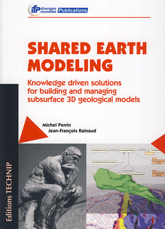
Shared earth modeling Knowledge driven solutions for building and managing subsurface 3D geological models
Langue : Anglais
Auteur : PERRIN Michel

This study of earth subsurface modeling is intended for several categories
of readers - geologists, engineers, and managers involved in the study and
evaluation of subsurface reservoirs and hydrocarbon exploration. The
authors cover progress in various fields of computer sciences such as
solid modeling or knowledge engineering, which can provide useful
techniques for solving several crucial issues concerning the modeling of
geological reservoirs. The book will also be of interest to researchers in
computer science. Problems of major importance have recently made their
appearance in earth modeling and are likely to provide opportunities for
researchers to implement some of the many innovative techniques that are
currently being developed, on actual case studies. More broadly, earth
modeling is a good example of an engineering field that involves complex
methodologies, a range of skills, and multiple participants. This book
will also be of interest to engineers, researchers, and students who wish
to apply advanced knowledge-based techniques to complex engineering
problems. Over the last two decades, earth modeling has become a major
investigative tool for evaluating the potential of hydrocarbon reservoirs.
During that time, significant progress has been made in interactive and
user-friendly software that is commonly used by professionals for oil and
gas exploration. At present, petroleum companies are facing a number of
challenges in exploration. Not only must they investigate newly identified
resources but, given existing hydrocarbon price fluctuations, they must
also re-evaluate the potential of previously investigated reservoirs,
examine new prospecting data, and consider divergent interpretations.
However, significant difficulties are involved. Earth models used for oil
and gas exploration and production rely on various types of raw data
(seismic data, well-log data, thin-section observation, rock sample
analyses). They are synthetic representations that incorporate a variety
of different interpretations made at successive steps of the modeling
process (seismic interpretation, stratigraphic correlations, petrological
property identification) by professionals with different interests and
abilities (geophysicists, geologists, petrologists, reservoir engineers).
At present, the modeling procedures currently in use in the industry
provide no way to link a range of data and interpretations with a final
earth model. In the best cases, these links can only be retrieved by
examining the written reports that accompany the model itself. This
situation is very unsatisfactory, and presents a serious obstacle to
evaluating the quality of a given model and improving it by modifying some
of the assumptions on which it rests.
Date de parution : 02-2013
Ouvrage de 400 p.
Thèmes de Shared earth modeling :
© 2024 LAVOISIER S.A.S.
