Description
Remote Sensing for Sustainability
Remote Sensing Applications Series
Language: English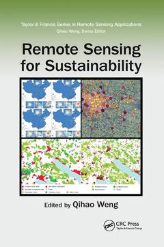
Subjects for Remote Sensing for Sustainability:
Keywords
Data Sets; Remote Sensing; leaf; MODIS AOD; area; Case Study; index; Lidar Data; land; Landsat Time Series; cover; Impervious Surfaces; spatial; AOD Product; resolution; Chapel Hill; moderate; NORTH CAROLINA; imaging; Visible Infrared Imaging Radiometer Suite; spectroradiometer; AOD Data; Life Form Compositions; NDWI Image; Meris; Solar Energy; Extracted Water Bodies; MODIS Fire; Worldview-2 Bands; Los Velocity; AOD Value; AOD Retrieval; SWIR Band; RS Image; Remote Sensing Algorithms

Publication date: 12-2019
· 15.6x23.4 cm · Paperback
Publication date: 11-2016
· 15.6x23.4 cm · Hardback
Description
/li>Contents
/li>Readership
/li>Biography
/li>
Driven by the societal needs and improvement in sensor technology and image processing techniques, remote sensing has become an essential geospatial tool for understanding the Earth and managing Human-Earth interactions. Remote Sensing for Sustainabilityintroduces the current state of the art remote sensing knowledge integral for monitoring the world?s natural resources and environments, managing exposure to natural disasters and man-made risks, and helping understand the sustainability and productivity of natural ecosystems.
Bridging the gap between remote sensing and sustainability science this book examines theories and methods as well as practical applications of sustainable development for cities using remote sensing; focuses on remote sensing methods and techniques for sustainable natural resources with emphasize on forests; answers questions on how and what the remote sensing methods and techniques can do for the sustainability of environmental systems; and examines the issues of energy use and sustainable energy sources using remote sensing technology in countries such as Germany, China, the U.S, drawing on case studies to demonstrate the applicability of remote sensing techniques.
This comprehensive guide, which can serve to professors, researchers, and students alike, takes in consideration the United Nations set of sustainable development goals and intends to contribute to the GEO?s Strategic Plan by addressing and exemplifying a number of societal benefit areas of remote sensing data sets, methods, and techniques for sustainable development.
Foreword. Preface. Editor. Contributors. Section I Remote Sensing for Sustainable Cities. Extraction of Parameters from Remote Sensing Data for Environmental Indices for Urban Sustainability. Earth Observation for Urban and Spatial Planning. Assessment of Urban Growth in the Pearl River Delta, China, Using Time Series Landsat Imagery. InSAR Monitoring of Land Subsidence for Sustainable Urban Planning. A Tale of Two Cities: Urbanization in Greensboro, North Carolina, USA, and Guiyang, Guizhou, China. Section II Remote Sensing for Sustainable Natural Resources. Role of Remote Sensing in Sustainable Grassland Management: A Review and Case Studies for a Mixed-Grass Prairie Ecosystem. Classifying Tree Species Using Fine Spatial Resolution Imagery to Support the Conservation of an Endangered Bird Species in Hawaii. Remote Sensing of Forest Damage by Diseases and Insects. Monitoring Water Quality with Remote Sensing Image Data. Section III Remote Sensing for Sustainable Environmental Systems. Urban Air Quality Studies Using EO Data. Heat Hazard Monitoring with Satellite-Derived Land Surface Temperature. Remote Sensing Identification of Threshold Zones along a Mediterranean to Arid Climatic Gradient. Remote Sensing Identification of Threshold Zones along a Mediterranean to Arid Climatic Gradient. Section IV Remote Sensing for Sustainable Energy. Earth Observation and Its Potential to Implement a Sustainable Energy Supply—A German Perspective. Use of Nighttime Imaging Data to Assess Decadal Trends in Energy Use in China. Support of Wind Resource Modeling Using Earth Observation—A European Perspective on the Status and Future Options. Assessing Solar Energy Potential and Building Energy Use in Indianapolis Using Geospatial Techniques. Index.
Dr. Qihao Weng is the director of the Center for Urban and Environmental Change and a professor of geography at Indiana State University, USA. In addition, he serves as editor-in-chief of ISPRS Journal of Photogrammetry and Remote Sensing and is the series editor for Taylor & Francis Series in Remote Sensing Applications. He received his PhD degree in geography from the University of Georgia in 1999. In the same year, he joined the University of Alabama as an assistant professor. Since 2001, he has been a member of the faculty in the Department of Earth and Environmental Systems at Indiana State University, where he has taught courses on remote sensing, digital image processing, remote sensing–GIS integration, GIS, and environmental modeling. He has mentored 15 doctoral and 13 master students. Dr. Weng’s research focuses on remote sensing and GIS analysis of urban ecological and environmental systems, land-use and land-cover change, environmental modeling, urbanization impacts and sustainability, and human–environment interactions. He is the author of more than 180 peer-reviewed journal articles and other publications and 9 books. Dr. Weng has worked extensively with optical and thermal infrared remote sensing data, and more recently with LiDAR data, primarily for urban heat island study, land-cover and impervious surface mapping, urban growth detection, image analysis algorithms, and the integration with socioeconomic characteristics, with financial support from US funding agencies that include NSF, NASA, USGS, USAID, NOAA, the National Geographic Society, and Indiana Department of Natural Resources. From the American Association of Geographers (AAG), Dr. Weng has received the Outstanding Contributions Award in Remote Sensing in 2011 and the Willard and Ruby S. Miller Award in 2015 for his outstanding contributions to geography. In May 2008, he received a prestigious NASA senior fellowship. Dr. Weng is also the recipient of th