Small-Format Aerial Photography and UAS Imagery (2nd Ed.) Principles, Techniques and Geoscience Applications
Auteurs : Aber James S., Marzolff Irene, Ries Johannes, Aber Susan Elizabeth Ward
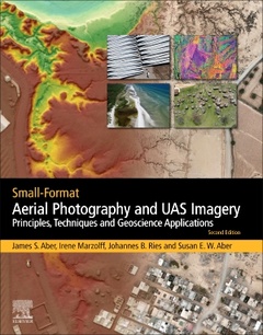
Small Format Aerial Photography and UAS Imagery: Principles, Techniques and Geoscience Applications, Second Edition, provides basic and advanced principles and techniques for Small Format Aerial Photography (SFAP), focusing on manned and unmanned aerial systems, including drones, kites, blimps, powered paragliders, and fixed wing and copter SFAP. The authors focus on everything from digital image processing and interpretation of data, to travel and setup for the best result, making this a comprehensive guide for any user. Nine case studies in a variety of environments, including gullies, high altitudes, wetlands and recreational architecture are included to enhance learning.
This new edition includes small unmanned aerial systems (UAS) and discusses changes in legal practices across the globe. In addition, the book presents the history of SFAP, providing background and context for new developments.
Part I. History and principles1. Introduction to small-format aerial photography 2. Basic principles of SFAP 3. Photogrammetry4. Lighting and atmospheric conditions5. Photographic composition
Part II. SFAP techniques6. Cameras for SFAP7. Manned and tethered platforms and mounts8. Unmanned aerial systems (UAS – drones) 9. SFAP survey planning and implementation10. Legal issues11. Image interpretation12. Image processing and analysis
Part III. Case studies13. Gully erosion monitoring14. Wetland environments15. Architecture, archaeology, and cemeteries 16. Recreational property17. Vegetation and soils18. Wind energy 19. Vineyards 20. Geomorphology21. Emergence of SFAP
graduate students, researchers and professionals in the areas of: Natural Resource management, environmental management, ecology, agricultural science, environmental science, energy, urban planning, physical geography, remote sensing, geology, geomorphology
Dr. Marzoff is a physical geographer and remote sensing/GIS scientist holding a Ph.D. from Freiburg University, Germany. She has been working on high-resolution remote sensing methods for monitoring land degradation and erosion since 1995. She has been involved in designing and building several unmanned platforms for small-format aerial photography and has developed remote-sensing and photogrammetry-based methods for quantifying geomorphological processes in high temporal and spatial resolution. She has collaborated in numerous research projects with colleagues from Belgium, Germany, India, Morocco, Spain and the USA
Dr. Ries holds a Ph.D. from Freiburg University, Germany. His research focusses on methodological questions regarding erosion, land degradation and desertification. His main expertise lies in experimental geomorphology, and small-format aerial and terrestrial photography has always been an integral part of his research concepts and projects. He has extensive international research cooperation and during recent years has conducted fieldwork mostly in semi-arid regions of Europe and Africa
Dr. Susan W. Aber is the Director of the Science and Math Education Center and Peterson Planetarium at Emporia State University (ESU), Emporia, Kansas USA. She is a geologist, graduate gemologist, map librarian, and university teacher. She taught in the Earth Science Department at ESU and was Federal Depository Map Librarian. She has taught LIS courses via distance education at San José State University and North Carolina Central Universi
- Provides background and context for new developments in SFAP
- Covers the legal implications for small format aerial systems in different countries
- Discusses unmanned aerial systems (drones) and their applications
- Features new case studies for different applications, including vineyard monitoring and impacts of wind energy
Date de parution : 09-2019
Ouvrage de 394 p.
21.4x27.6 cm