Description
Tables Requisite to Be Used with the Nautical Ephemeris, for Finding the Latitude and Longitude at Sea
Published by Order of the Commissioners of Longitude
Cambridge Library Collection - Mathematics Series
Author: Maskelyne Nevil
Published in 1802, the revised third edition of tables and instructions used by navigators at sea to determine their position.
Language: English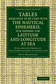
Subject for Tables Requisite to Be Used with the Nautical Ephemeris...:
Approximative price 35.47 €
In Print (Delivery period: 14 days).
Add to cart the print on demand of Maskelyne Nevil
Publication date: 03-2014
Support: Print on demand
Support: Print on demand
Description
/li>Contents
/li>
Successful long-distance navigation depends on knowing latitude and longitude, and the determination of longitude depends on knowing the exact time at some fixed point on the earth's surface. Since Newton it had been hoped that a method based on accurate prediction of the moon's orbit would give such a time. Building on the work of Euler, Thomas Mayer and others, the astronomer and mathematician Nevil Maskelyne (1732?1811) was able to devise such a method and yearly publication of the Nautical Almanac and Astronomical Ephemeris placed it in the hands of every ship's captain. First published in 1767 and reissued here in the revised third edition of 1802, the present work provided the necessary tables and instructions. The development of rugged and accurate chronometers eventually displaced Maskelyne's method, but navigators continued to make use of it for many decades. This edition of the tables notably formed part of the library of the Beagle on Darwin's famous voyage.
Preface; Tables 1-30; General introduction; Explanation of the tables; Problems 1-13.
© 2024 LAVOISIER S.A.S.