Description
Extreme Hydroclimatic Events and Multivariate Hazards in a Changing Environment
A Remote Sensing Approach
Coordinators: Maggioni Viviana, Massari Christian
Language: English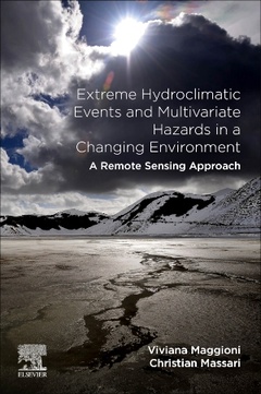
Subject for Extreme Hydroclimatic Events and Multivariate Hazards in...:

438 p. · 15x22.8 cm · Paperback
Description
/li>Contents
/li>Readership
/li>Biography
/li>Comment
/li>
Extreme Hydroclimatic Events and Multivariate Hazards in a Changing Environment: A Remote Sensing Approach reviews multivariate hazards in a non-stationary environment, covering both short and long-term predictions from earth observations, along with long-term climate dynamics and models. The book provides a detailed overview of remotely sensed observations, current and future satellite missions useful for hydrologic studies and water resources engineering, and a review of hydroclimatic hazards. Given these tools, readers can improve their abilities to monitor, model and predict these extremes with remote sensing.
In addition, the book covers multivariate hazards, like landslides, in case studies that analyze the combination of natural hazards and their impact on the natural and built environment. Finally, it ties hydroclimatic hazards into the Sendai Framework, providing another set of tools for reducing disaster impacts.
Part I: Water cycle variables for monitoring hydroclimatic hazards: state-of-the-art and future directions 1. Precipitation 2. Terrestrial Water Storage 3. Soil Moisture 4. Water Surface Elevation 5. Evaporation 6. Vegetation
Part II: Remote sensing and modeling techniques for monitoring and predicting hydroclimatic hazards: Perspectives and Applications 7. Studying extreme precipitation events in mountainous regions with satellite-based precipitation products 8. Spatiotemporal patterns of precipitation concentration, aggressiveness, and seasonality in Bangladesh 9. Characterizing meteorological droughts in data scarce regions using remotely sensed precipitation 10. Recent advances in remote sensing of precipitation and soil moisture for riverine flood prediction 11. Using altimetry and optical sensors for monitoring and forecasting river discharge 12. Inundation mapping using remote sensing techniques 13. Storm Surge and Sea Level Rise: Threat to the Coastal Areas of Bangladesh 14. Hazard assessment and forecasting of landslides and debris flows: A case study in Northern Italy 15. Remote sensing-based techniques for avalanche risk assessment and forecasting
meteorologists, climatologists, hydrologists, agronomists, geologists, geographers, water resource scientists and managers, scientists and environmental managers focusing on climate change, researchers whose focus is on sustainability, land use, disaster management, risk-assessment, and risk reduction
Christian Massari, PhD, is permanent researcher at the Research Institute for the Geo-Hydrological Protection (IRPI) of the National Research Council (CNR) of Italy. Thanks to a graduate research fellowship, he spent a year in the Department of Hydrology and Water Resources at the University of Arizona, Tucson, AZ in 2011. After returning to Italy, he was a postdoctoral research fellow in the hydrology and remote sensing group at IRPI, where he is a permanent researcher since January 2017. His research interests include data fusion and data assimilation of hydrological variables (e.g., soil moisture and rainfall), hydro-validation of satellite soil moisture and rainfall observations, filtering of satellite soil moisture, flooding risk analysis, and flood frequency assessment.
- Emphasizes recent and future satellite missions to study, monitor and forecast hydroclimatic hazards
- Provides a complete overview and differentiation of remotely sensed products that are useful for monitoring extreme hydroclimatic and related events
- Covers real-life examples and applications of integrating remote sensing products to study complex multi-hydroclimatic hazards