Description
Understanding Forest Disturbance and Spatial Pattern
Remote Sensing and GIS Approaches
Coordinators: Wulder Michael A., Franklin Steven E.
Language: English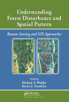
Subjects for Understanding Forest Disturbance and Spatial Pattern:
Keywords
Landscape Metrics; Remote Sensing; remote; Forest Disturbance; sensing; Landscape Pattern Indices; land; GIS Data; cover; Burn Scar; thematic; Forest Disturbance Mapping; mapper; Pattern Analysis; landscape; Active Fire Detection; metrics; Sketch Map; leaf; Burn Scar Mapping; area; Insect Defoliation; GIS Approach; Salvage Cuts; Burn Severity Maps; Normalized Burn Ratio; Burned Areas; Tasseled Cap Indices; Time Period; Tasseled Cap; Effective Mesh Size; Fire Disturbances; Soil Scientists; High Spatial Resolution Imagery; Regeneration Harvest

Publication date: 06-2020
· 15.6x23.4 cm · Paperback
Publication date: 07-2006
250 p. · 15.6x23.4 cm · Hardback
Description
/li>Contents
/li>Readership
/li>Biography
/li>
Remote sensing and GIS are increasingly used as tools for monitoring and managing forests. Remotely sensed and GIS data are now the data sources of choice for capturing, documenting, and understanding forest disturbance and landscape pattern. Sitting astride the fields of ecology, forestry, and remote sensing/GIS, Understanding Forest Disturbance and Spatial Pattern: Remote Sensing and GIS Approaches takes you through the general biological or landscape ecological context of forest disturbance to remote sensing and GIS technological approaches and pattern description and analysis, with compelling applied examples of integration and synthesis.
Written by experts, peer-reviewed to adhere to the strictest standards and highest quality criteria, these chapters discuss natural and human-caused forest change and consider factors such as biological setting, monitoring approaches, scale issues, and pattern analysis. The book explores forest disturbance and spatial pattern from an ecological point-of-view within the context of structure, function, pattern, and change. It concludes with a summary of the issues related to detection and mapping of forest disturbances with remotely sensed and GIS data. The authors elucidate how the elements presented, from ecological underpinnings, data considerations, change detection method, and pattern analysis, combine into a problem solving, information generating approach.
You may find this subject covered briefly in a small sub-section in remote sensing forestry texts, or in limited technical detail in the ecology literature. The in-depth, detailed information provided in this book allows you to develop an understanding of the application of BOTH remote sensing and GIS technologies to forest change and the impacts of fire, insect infestation, forest harvesting, and other potential change influences ? such as extreme weather events. This book provides guidance on how to master the challenges of capturing and characterizing forest disturbance and spatial patterns.