


Description
GIS Applications in Agriculture
GIS Applications in Agriculture Series
Coordinators: Pierce Francis J., Clay David
Language: English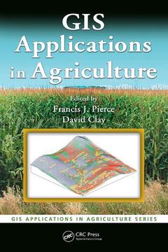
Subjects for GIS Applications in Agriculture:
Keywords
Data Set; Spatial Analyst; inverse; Spatial Analyst Extension; distance; Fertilizer Recommendations; weighting; Sugar Beet Tops; spatial; Patch Spraying; analyst; Soil Test Levels; extension; Ramsey County; precision; IDW Interpolation; ordinary; Salinity Map; kriging; Grid Cell Averaging; symbology; Top Tool Bar; Yield Monitor Data; Ok; Soil Salinity; Boundary Shapefile; Soil Mechanical Resistance; Partial Budget; Sugar Beet; SSURGO Database; Runoff Class; Gps Data; Soil Electrical Conductivity; Salinity Data; Weed Population

203 p. · 15.6x23.4 cm · Hardback
Description
/li>Contents
/li>Readership
/li>Biography
/li>
The increased efficiency and profitability that the proper application of technology can provide has made precision agriculture the hottest developing area within traditional agriculture. The first single-source volume to cover GIS applications in agronomy, GIS Applications in Agriculture examines ways that this powerful technology can help farmers produce a greater abundance of crops with more efficiency and at lower costs.
Each chapter describes the nature of a problem, examines the purpose and scope of a GIS application, presents the methods used to develop the application, and then goes on to provide results and offer a conclusion as well as supporting information. When appropriate, the chapters present the underlying statistical approach for the GIS software that is used. Applicable data sets and color maps produced by use of GIS are included for download at the CRC webiste.
Concentrating more on the approach and less on the specific software, the authors describe the methods used to develop an application and discuss limitations to the algorithms and the programming code used. They then summarize the application in terms of what it does, how it works, its limitations, and its potential uses. The book provides a toolkit for the acquisition, management, and analysis of spatial data throughout the agriculture value chain.
These books may interest you

Online GIS and Spatial Metadata 142.04 €