Description
Land Resources Monitoring, Modeling, and Mapping with Remote Sensing
Remote Sensing Handbook Series
Coordinator: Thenkabail, Ph.D. Prasad S.
Language: English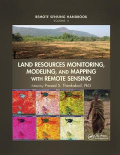
Subjects for Land Resources Monitoring, Modeling, and Mapping with...:
Keywords
Land Surface Water Index; Spaceborne LiDAR; Airborne LiDAR; Envisat ASAR; LiDAR Data; VIIRS; Remote Sensing; ALS Data; LiDAR Remote Sensing; Hyperspectral Vegetation Indices; Land Cover Change Detection; Soil Science; Forest Resource Information; Canopy Biophysical Variables; Cropland Mapping; Data Sets; Remote Sensing Data; SAR Image; Weld; Hyperspectral Data; Radiative Transfer Models; AGB Estimate; Vegetation Index; Spectral Sensing; Precision Farming

Publication date: 12-2019
· 21x28 cm · Paperback
Publication date: 11-2015
· 21x28 cm · Hardback
Description
/li>Contents
/li>Biography
/li>
A volume in the three-volume Remote Sensing Handbook series,Land Resources Monitoring, Modeling, and Mapping with Remote Sensing documents the scientific and methodological advances that have taken place during the last 50 years. The other two volumes in the series are Remotely Sensed Data Characterization, Classification, and Accuracies, and Remote Sensing of Water Resources, Disasters, and Urban Studies.
In true handbook style, the chapters in the volume have been carefully selected, organized, and designed to be self-contained so that you can focus on a chapter and read it through without having to be overly dependent on other chapters. This volume provides comprehensive theoretical and practical coverage of remote sensing of land resources that include vegetation and biomass, agricultural croplands, rangelands, phenology and food security, forests, biodiversity, ecology, land use\land cover, carbon, and soils.
Highlights include:
- Global terrestrial carbon and carbon budgets
- Precision farming
- Agricultural systems studies and soil studies
- Global croplands, agricultural croplands, and rangelands
- Food security analysis
- Biodiversity
- Land use and land cover mapping
- Measuring photosynthesis from space
- Vegetation characterization and above ground biomass measurements and modeling
- Hyperspectral remote sensing
- Ecological studies
- Tropical forest characterization
- Habitat mapping and monitoring
In a very practical way, the book demonstrates the experience, utility, methods, and models used in studying a wide array of land applications. Considered magnum opus on the subject, the three-volume Remote Sensing Handbook is edited by Dr. Prasad S. Thenkabail, a renowned international expert in remote sensing science, GIScience, and spatial sciences, with contributions from some of the very best leading global experts, the handbook gives you a knowledge base on the evolution remote sensing science, state-of-the-art technology, and a future vision for the field.
VEGETATION AND BIOMASS. Monitoring Photosynthesis from Space. Canopy Biophysical Variables Retrieval from the Inversion of Reflectance Models. Aboveground Terrestrial Biomass and Carbon Stock Estimations from Multisensor Remote Sensing. AGRICULTURAL CROPLANDS. Agriculture. Agricultural Systems Studies Using Remote Sensing. Global Food Security Support Analysis Data at Nominal 1 km (GFSAD1km) Derived from Remote Sensing in Support of Food Security in the Twenty-First Century: Current Achievements and Future Possibilities. Precision Farming. Remote Sensing of Tillage Status. Hyperspectral Remote Sensing for Terrestrial Applications. RANGELANDS. Global View of Remote Sensing of Rangelands: Evolution, Applications, Future Pathways. Remote Sensing of Rangeland Biodiversity. Characterization, Mapping, and Monitoring of Rangelands: Methods and Approaches. PHENOLOGY AND FOOD SECURITY. Global Land Surface Phenology and Implications for Food Security. FORESTS. Characterizing Tropical Forests with Multispectral Imagery. Remote Sensing of Forests from Lidar and Radar. Forest Biophysical and Biochemical Properties from Hyperspectral and LiDAR Remote Sensing. Optical Remote Sensing of Tree and Stand Heights. BIODIVERSITY. Biodiversity of the World: A Study from Space. Multiscale Habitat Mapping and Monitoring Using Satellite Data and Advanced Image Analysis Techniques. ECOLOGY. Ecological Characterization of Vegetation Using Multisensor Remote Sensing in the Solar Reflective Spectrum. LAND USE/LAND COVER. Land Cover Change Detection. Land Use and Land Cover Mapping and Change Detection and Monitoring Using Radar Remote Sensing. CARBON. Global Carbon Budgets and the Role of Remote Sensing. SOILS. Spectral Sensing from Ground to Space in Soil Science: State of the Art, Applications, Potential, and Perspectives. Remote Sensing of Soil in the Optical Domains. SUMMARY. Remote Sensing of Land Resources: Monitoring, Modeling, and Mapping Advances over the Last 50 Years and a Vision for the Future.