Description
Remote Sensing of Natural Resources
Remote Sensing Applications Series
Coordinators: Wang Guangxing, Weng Qihao
Language: English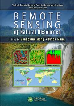
Subjects for Remote Sensing of Natural Resources:
Keywords
LiDAR Data; RS Data; remote sensing applications; LULC Type; Remote sensing; LiDAR Point Cloud; Algorithms; RS Image; Natural resource applications; Accuracy assessment; LiDAR System; Sampling design; Tree Species Classification; Change detection; LULC Category; Impervious surface; LiDAR Metric; Forestry and agricultural mapping; ALOS PALSAR; Land use and land cover; Airborne LiDAR; Error Matrix; End Members Selection; Hyperspectral Data; LSMA; Profile LiDAR; LiDAR Remote Sensing; Vegetation Cover Factor; IRS Image; Sample Plots; Tree Crown Boundaries; Reference Data; LULC Classification

Publication date: 07-2013
Support: Print on demand
Publication date: 09-2020
· 17.8x25.4 cm · Paperback
Description
/li>Contents
/li>Biography
/li>
Highlighting new technologies, Remote Sensing of Natural Resources explores advanced remote sensing systems and algorithms for image processing, enhancement, feature extraction, data fusion, image classification, image-based modeling, image-based sampling design, map accuracy assessment and quality control. It also discusses their applications for evaluation of natural resources, including sampling design, land use and land cover classification, natural landscape and ecosystem assessment, forestry, agriculture, biomass and carbon-cycle modeling, wetland classification and dynamics monitoring, and soils and minerals mapping.
The book combines review articles with case studies that demonstrate recent advances and developments of methods, techniques, and applications of remote sensing, with each chapter on a specific area of natural resources. Through a comprehensive examination of the wide range of applications of remote sensing technologies to natural resources, the book provides insight into advanced remote sensing systems, technologies, and algorithms for researchers, scientists, engineers, and decision makers.
Remote Sensing Systems, Data, and Applications. RS Applications for Sampling Design of Natural Resources. Advanced Algorithms for Accuracy and Quality Assessment of RS Products. RS Applications for Land Use and Land Cover Classification. RS Applications for Natural Landscape and Ecosystems. RS Applications for Forestry. RS Applications for Agriculture. RS Applications for Biomass and Carbon Cycle Modeling. RS Applications for Wetland Classifications and Dynamics Monitoring. RS Applications for Soils and Minerals Mapping.
Guangxing Wang, PhD, is an associate professor of remote sensing and geographic information systems (GIS) in the Department of Geography and Environment Resources at Southern Illinois University at Carbondale (SIUC), Illinois.
Qihao Weng, PhD is the director of the Center for Urban and Environmental Change and a Professor of geography at Indiana State University.